Search an address or tap the map to instantly see a property's real boundaries, its exact size, and everything on official record — then send your client a branded report. It's the Surveyor-General's data, turned into an app anyone can use.
Today the answers are scattered, technical, or locked away in software built for surveyors. PropMap brings them together on one simple map.
“Where does it actually start and end?”
A pin on Google Maps or a vague description won't show you a property's true boundaries. Guesswork loses deals and starts disputes.
“How big is it, really?”
Erf sizes and stand dimensions are buried in documents — or trapped behind expensive, complicated GIS software meant for professionals.
“Is this even up to date?”
Municipal portals, boundary databases and old PDFs rarely agree, and none of them fit in your pocket when you're standing on site.
PropMap draws directly on the official cadastre from the Chief Surveyor-General — so every property in the country is right there: accurate, labelled, and a tap away.
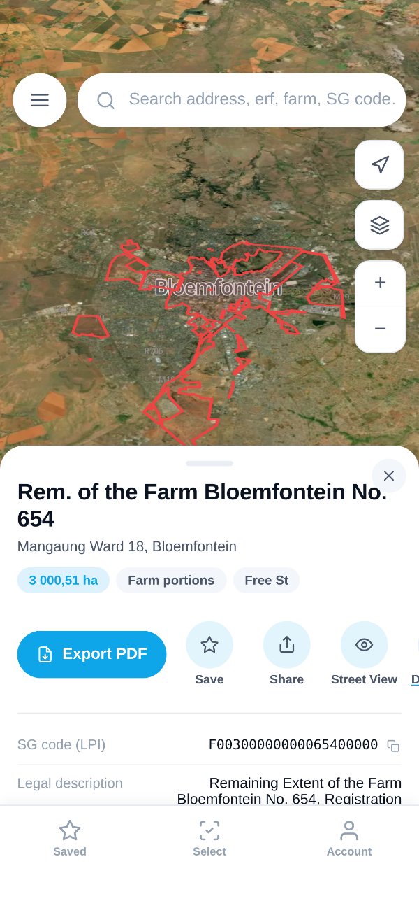
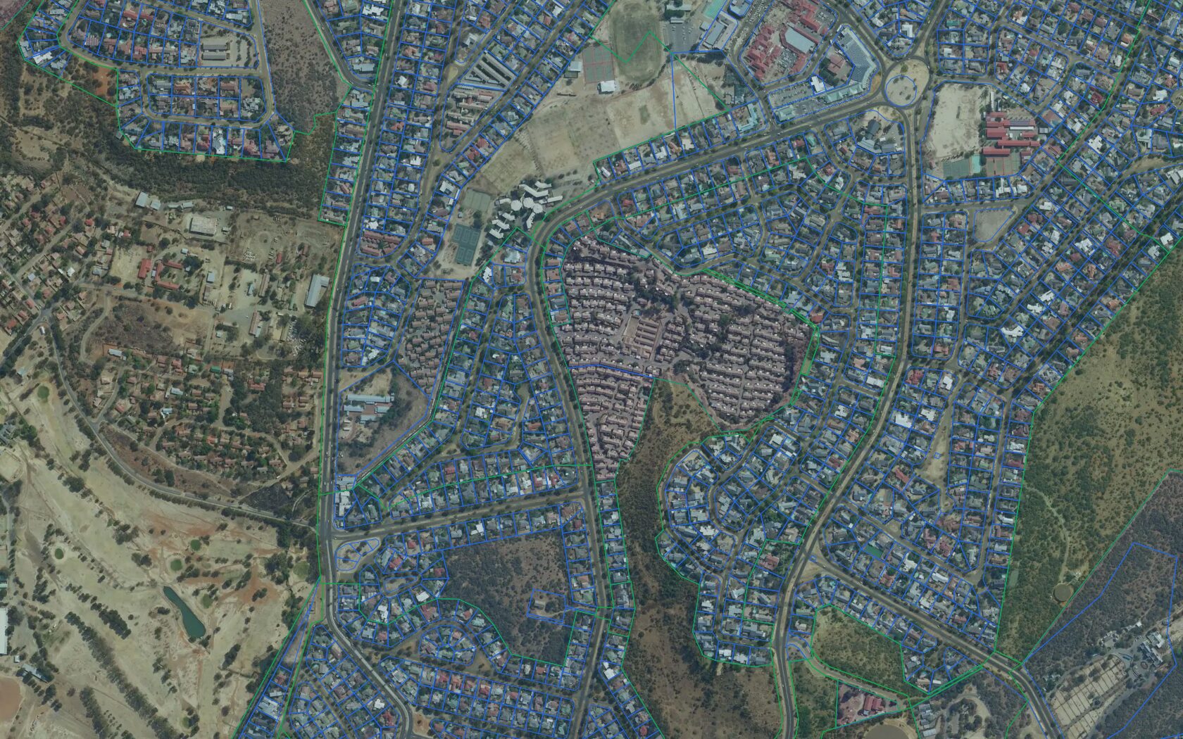
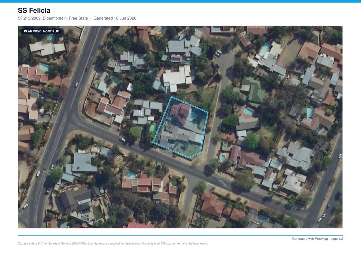
Tap any stand and its true outline appears on high-resolution satellite imagery — the same boundary the Surveyor-General surveyed, not a rough guess. Know precisely what you're selling, buying or valuing.
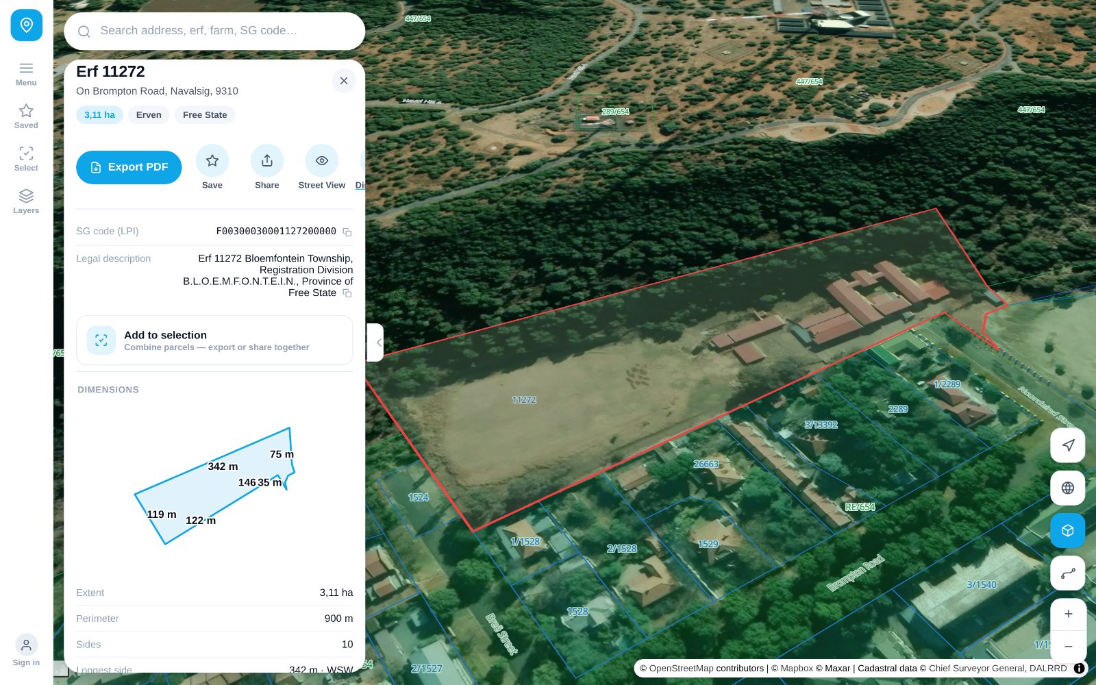
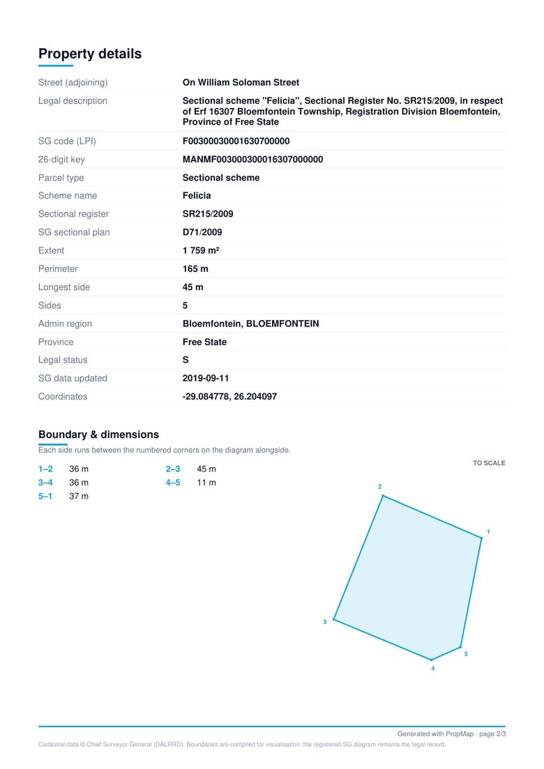
Size in hectares, perimeter, erf and farm numbers, the official 21-digit SG code, even a to-scale diagram of the stand with every side measured. No jargon, no digging through documents.
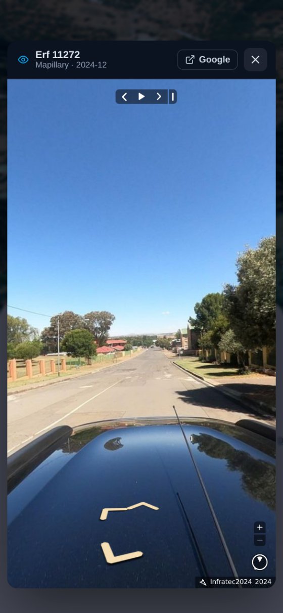
Drop into recent street-level imagery to scout access, the neighbours and the condition of a property — without driving out to it. You see the latest views available, never years-old photos.
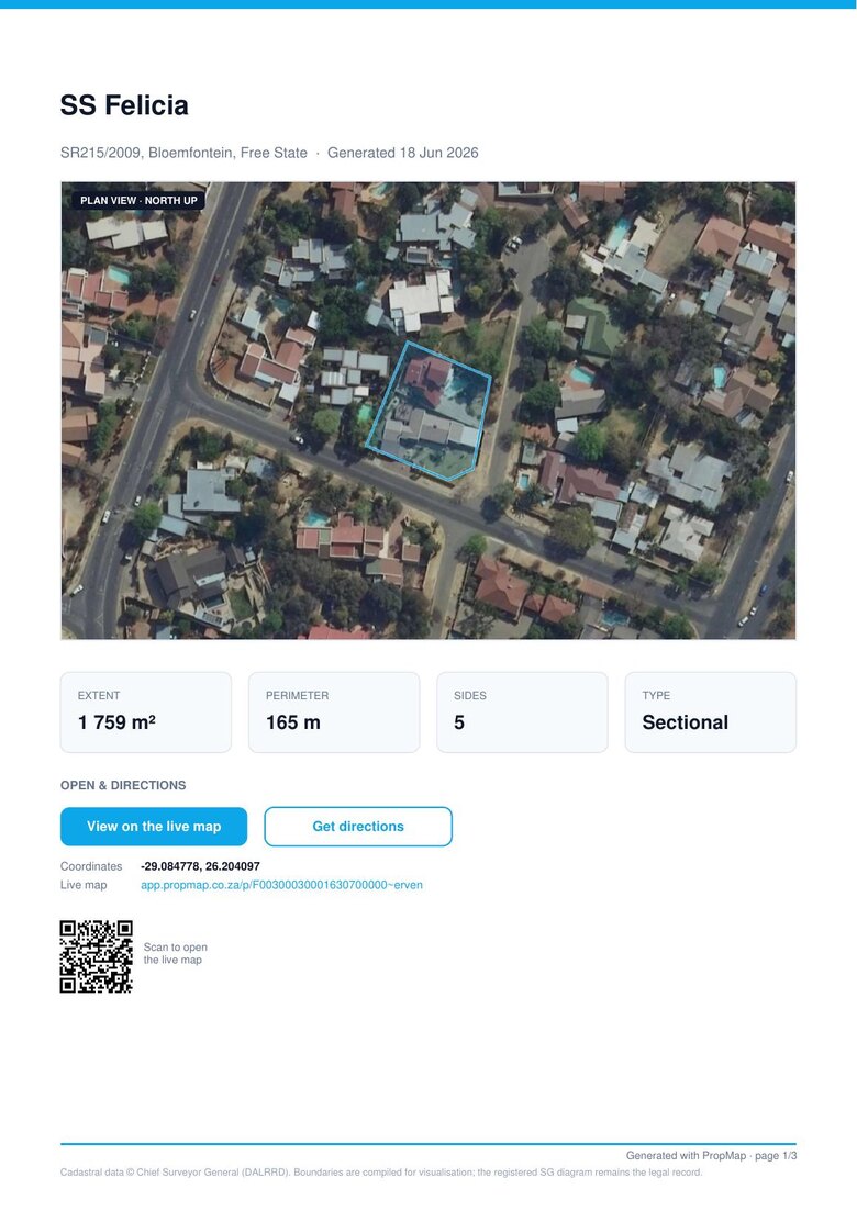
Turn any property — or a whole selection — into a polished report: a full-page plan view, oblique site perspectives, every official detail, and your own logo and colours. Or a clean map-only one-pager. Your client gets something that looks like it took hours.
The little things that turn a map into a workday tool.
Turn any property into a clean PDF in your agency's logo and colours — in two taps.
Group several properties, see their combined size, and export to CSV, GeoJSON or KML.
Find a property by address, erf or farm number, or its 21-digit SG code.
Star the properties you're working on and group them so they're always one tap away.
Switch between satellite, aerial and street maps, with a clean 3D tilt for context.
A fast, map-first app that works in the office or on site, and installs on your phone.
No GIS expertise required.
Search an address, erf or farm — or just tap it on the map. The official parcel loads instantly.
See the boundaries, size, dimensions and SG details, with satellite and street views alongside.
Save it, build a selection, export the data, or send a branded PDF report straight to your client.
Start free. Upgrade in-app when you’re ready — pay monthly, or save with annual.
The whole map of South Africa, in your pocket.
For the agent who closes in the field.
For teams and commercial deal-makers.
Need your brand front-to-back — no PropMap marks, your logo & colours across the app, on your own domain? Talk to us about Enterprise →
Join the South African agents who use PropMap to find, understand and present property — accurately.
Open the app — it's free